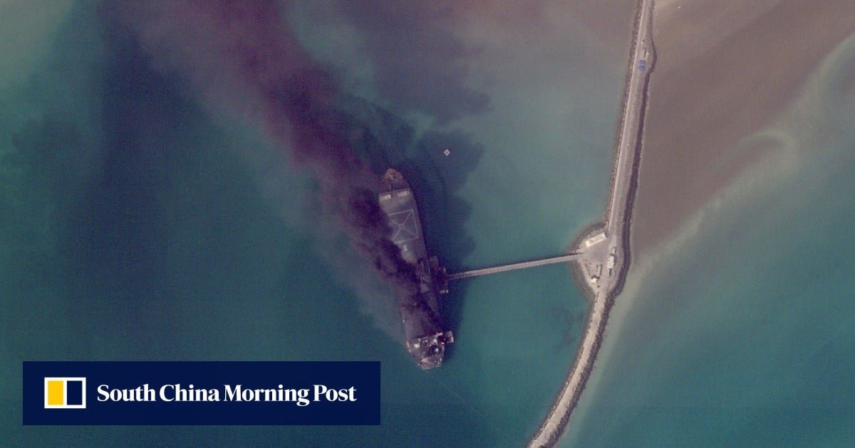
Satellite images have begun to be released, giving an image of the dire situation of the Iran war, with ships burning in an Iranian port and destroying buildings in a US base.
News has so far been scant about the damage being done across the Middle East, particularly inside closed military bases, since the start of the war on February 28.
The images are from Planet Labs PBC, a San Francisco company used by the media, including the Associated Press. Planet Labs has delayed its image from being made public for two weeks, citing concerns that its image could be used by “inappropriate actors”.
High-resolution images are also published by competing companies. Other providers, such as the US Geological Survey, have been publishing low-resolution images as well that have been useful.
The US and Israel have been hitting a variety of targets, including leaders, military bases, missile and air defense sites and positions of the military Revolutionary Guard and its volunteer force, the Basij. Iran has responded by using drones and missiles to target Israel and neighboring Arab Gulf states.